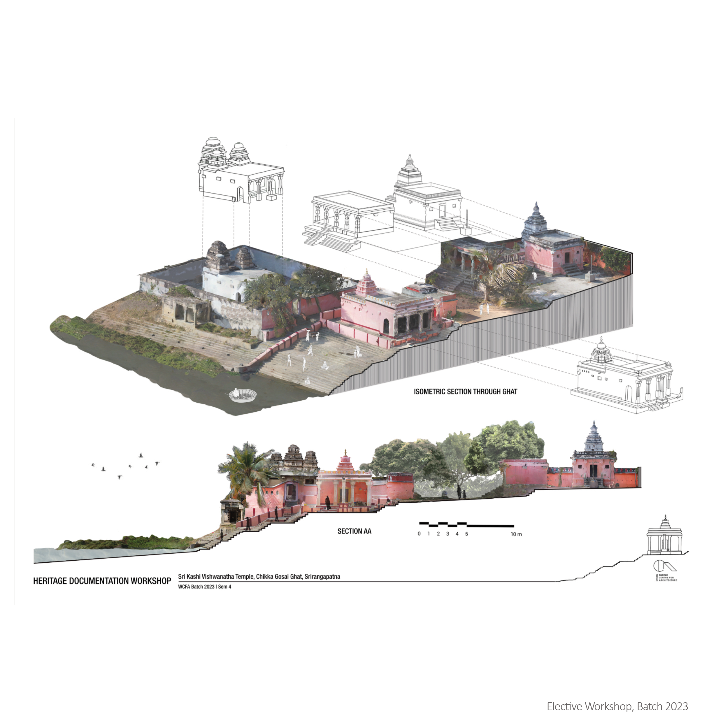
In our Semester 4 elective, “Heritage Documentation,” we utilized drone-mounted LiDAR scanning to capture detailed 3D models of a historical site. This non-intrusive method enabled precise documentation of intricate architectural features, even in areas difficult to access . To enhance accuracy, we supplemented the LiDAR data with manual measurements of key dimensions on-site. This combined approach ensured comprehensive and precise documentation
Faculty : Shashank Satish , Expert : Ragul Ravichandran
Medium: Meta Shape(LiDAR), Photoshop, Procreate
Time Taken: 24 hours across a month
